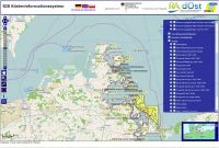
Coastal GIS
EUCC-Germany offers spatial information (geo-information) alongside its thematic information regarding coastal and marine topics. Geospatial information offers not only details on the type and intensity of uses, protection approaches, or various processes, but also shows where and in what relationship to our coasts and seas these uses occur. These tools support the findings of goal-oriented management on a broad actor level.
EUCC-Germany currently maintains the following GIS web-portals:
GIS IKZM Oder
GIS Odermündung/Pommersche Bucht (German)
Wadden Sea Region Planning Portal
The “Wadden Sea Region Planning Portal” is an innovative user-based map application for the Wadden Sea Region. With it, information about the mainland, the coast, and the open sea of the Netherlands, Denmark, and Germany can for the first time be communally shared and analyzed. This portal shows current existing and planned uses, as well as protection measures in place and topographic information. As a result, it provides a useful contribution for integrated management and maritime spatial planning in the region.
The Wadden Sea Forum e.V. (WSF) and EUCC - Die Küsten Union Deutschland e.V (EUCC-D) currently cooperatively operate the portal, and strive to not only keep existing data up to date but also to add additional thematic data.
- WaddenGIS (German)

